Share what you know,
and discover more.
Share what you know,
and discover more.
Jun 01, 1800
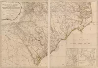

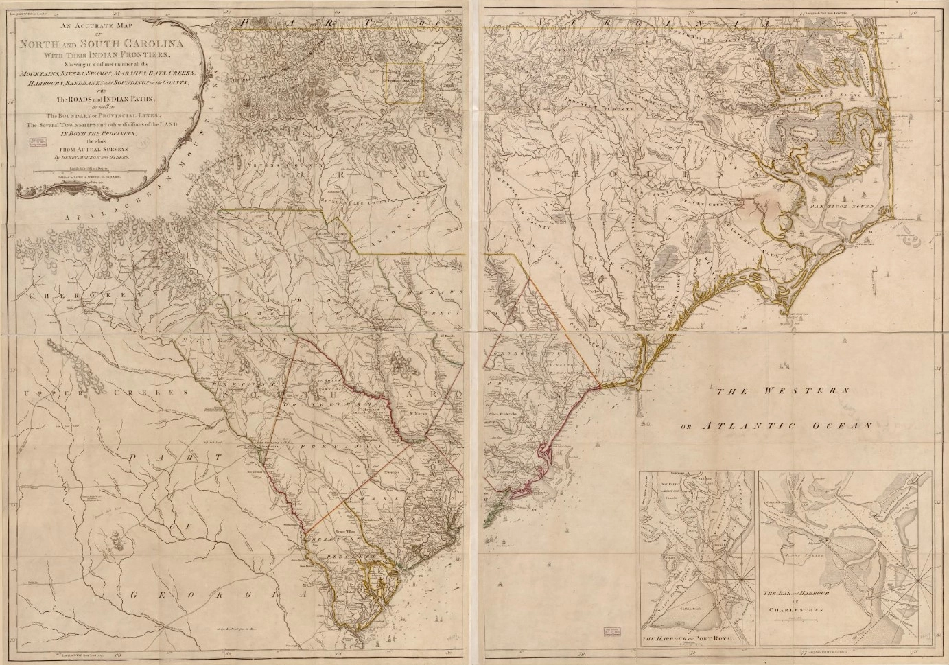
Map of North and South Carolina with their Indian frontier
An accurate map of North and South Carolina with their Indian frontier, showing distinctly all the mountains, rivers, swamps, marshes, bays, creeks, harbors, sandbank, and soundings on the coasts with the roads and Indian paths as well as the boundary or provincial lines, the several townships, and other divisions of the land in both the provinces.
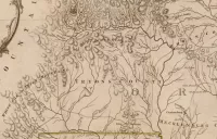
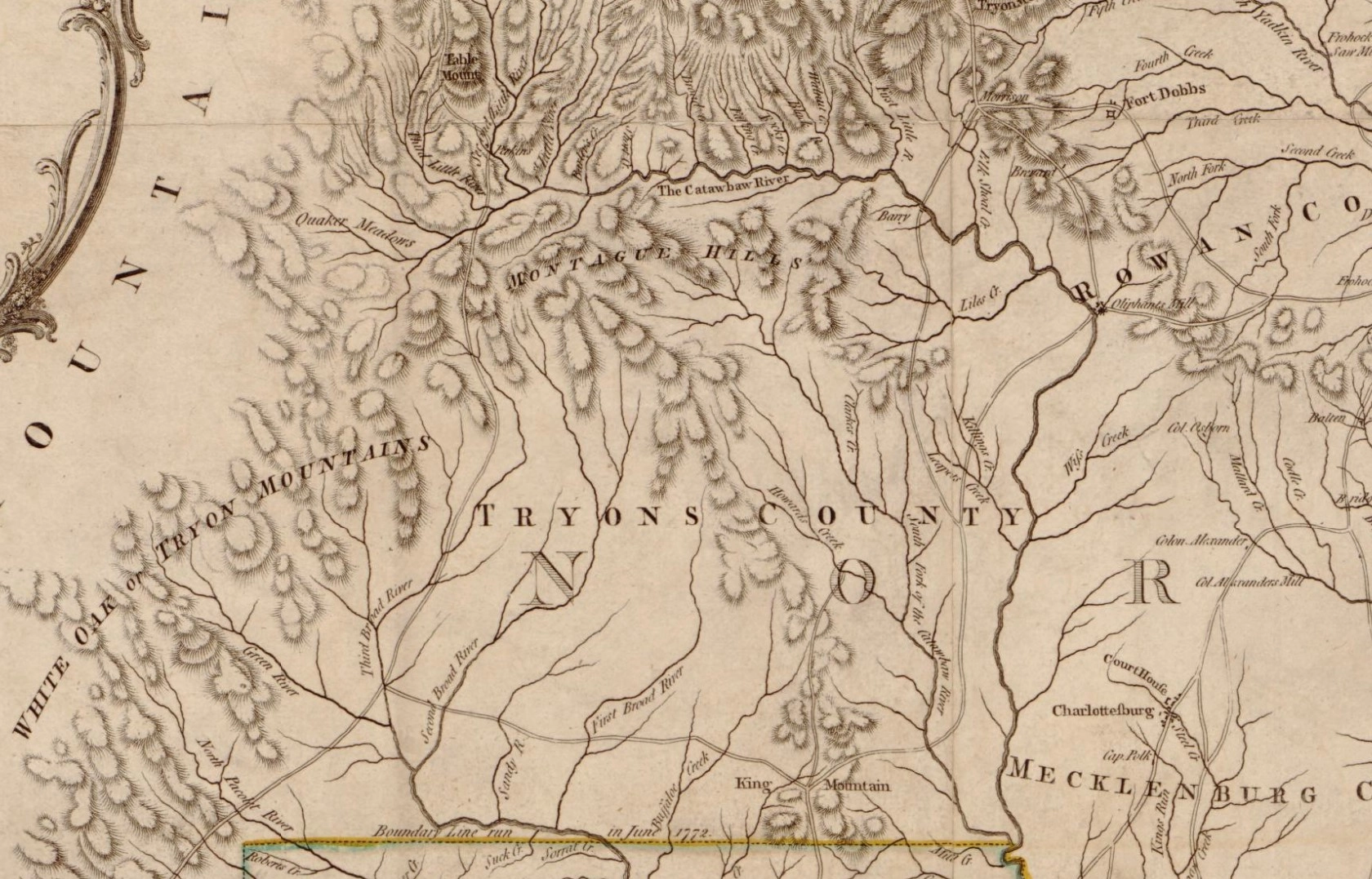
Jun 01, 1800
Posted Date
Jun 25, 2024
Historical Record Date
Jun 01, 1800
Source Name
Library of Congress
